Contact us!

In the world of infrastructure and railway asset management, capturing high-quality data is only half the battle. A 3D digital twin offers an incredible snapshot of reality at an exact moment. However, infrastructure is alive—it shifts, wears down, and evolves due to environmental factors and daily usage.
To maintain safety and optimize operational costs, managers don't just need to see their assets; they need to understand their evolution.
This is where the Comparative Analysis tool in the Workspace application becomes a game-changer.
Moving Beyond Static Data
Traditional asset monitoring often relies on comparing current site observations with old, flat reports or disparate data silos. This process is time-consuming and prone to human error.
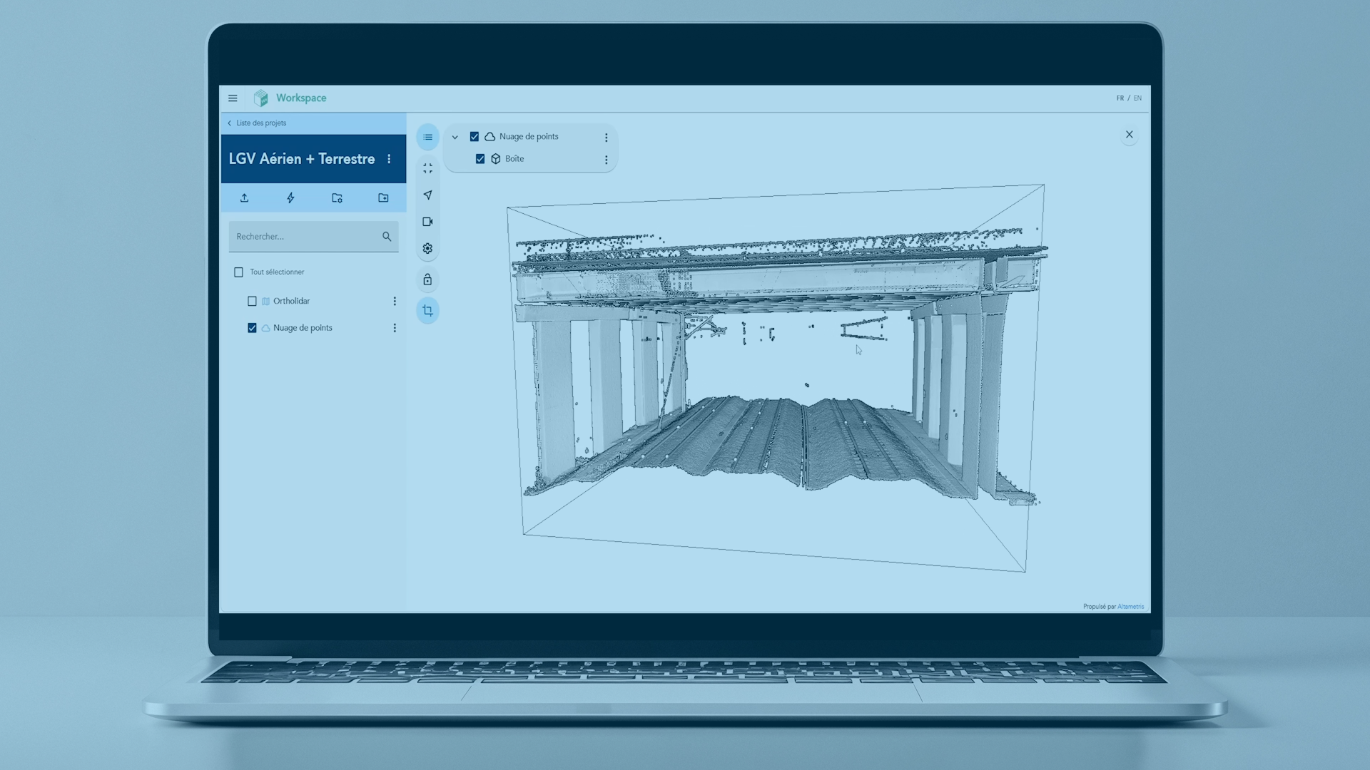
Workspace changes the paradigm by allowing users to bring different historical layers into a single, intuitive 3D interface. By centralizing aerial and terrestrial data, the platform provides a clear, undeniable view of structural changes.
3 Key Pillars of Workspace’s Comparison Tool
1. Seamless Temporal Overlay
The core of the comparison feature is the ability to map two distinct datasets—captured weeks, months, or years apart—directly on top of each other. Whether you are analyzing massive 3D point clouds or high-resolution 2D views, the software aligns them perfectly. This allows teams to visually track earthworks, vegetation growth, or structural wear without leaving their desks.
2. Millimeter-Accurate Deviation Detection
In sectors like railway maintenance, a discrepancy of a few centimeters can have critical safety implications. Workspace enables expert users to:
- Isolate specific zones of interest using advanced clipping tools.
- Measure precise distances, heights, and clearances between the two historical states.
- Identify structural deformation or shifting in assets like catenary structures, bridges, or retaining walls.
3. Data-Driven Decision Making
Data is only valuable if it drives action. By highlighting the exact differences between "Version A" and "Version B," Workspace transforms raw spatial data into actionable maintenance insights.
- Before/After Validation: Easily audit a site post-construction to ensure the work matches the initial requirements.
- Predictive Planning: Track the rate of degradation to schedule maintenance right before a failure occurs, shifting your strategy from reactive to truly preventive.
Designed for the Field, Built for Strategy
Workspace bridges the gap between field surveyors and office-based project managers. The interface is optimized to handle massive volumes of data at scale while remaining simple enough for daily operational use. You don't need to be a GIS expert to extract value; the platform highlights the evolution, and you make the call.
Conclusion: The Dynamic Future of Digital Twins
Static digital twins belong to the past. The future of infrastructure maintenance lies in dynamic, chronological tracking. By mastering the comparison tools within the Altametris Suite Workspace application, industries can safeguard their infrastructure, protect field teams, and invest their maintenance budgets where they matter most.
Watch the tutorial :