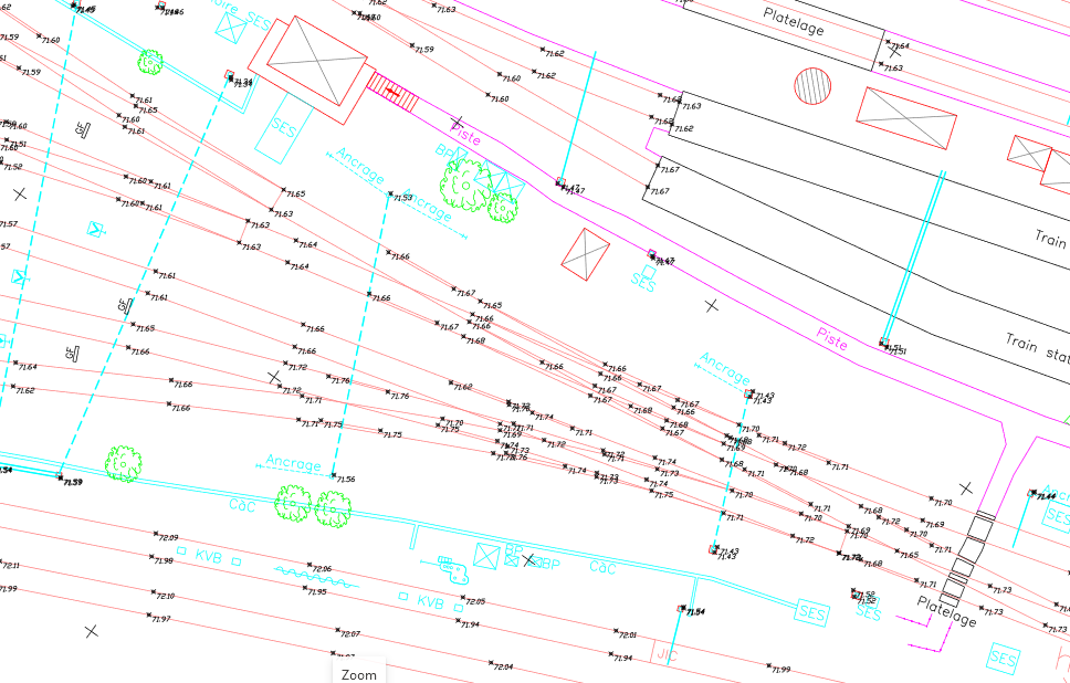
Access to data quickly for preparing projects in the emerging phase
To support you from the very beginning of your projects and throughout the project, we have designed a specific offering that allows you:
Would you like to learn more about this service?

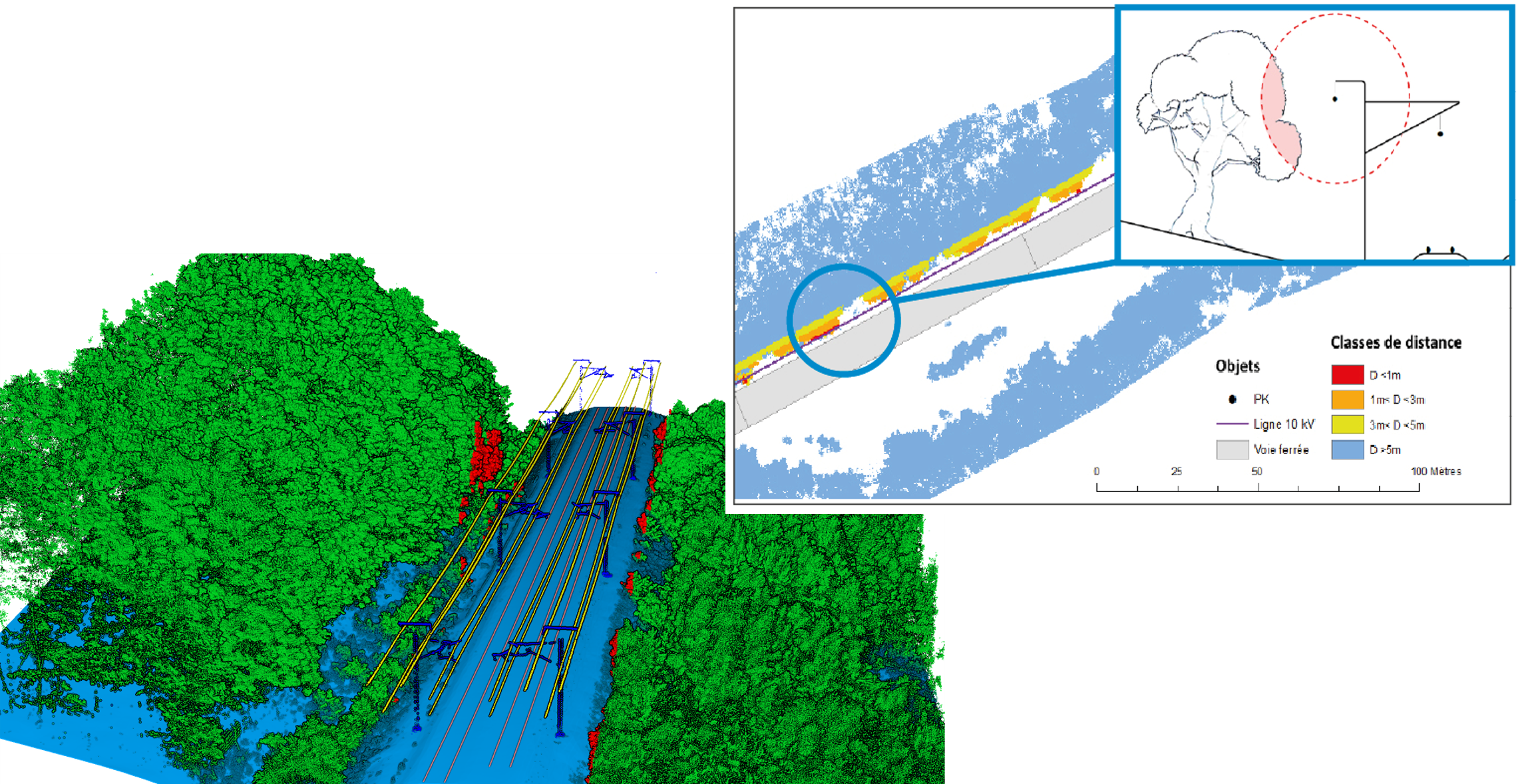
Characterizing dangerous vegetation along the tracks
Vegetation is the second most significant cost item in the management of the French railway network. To enable managers to optimize control, we automate data analysis over very long distances to:
Would you like to learn more about this service?
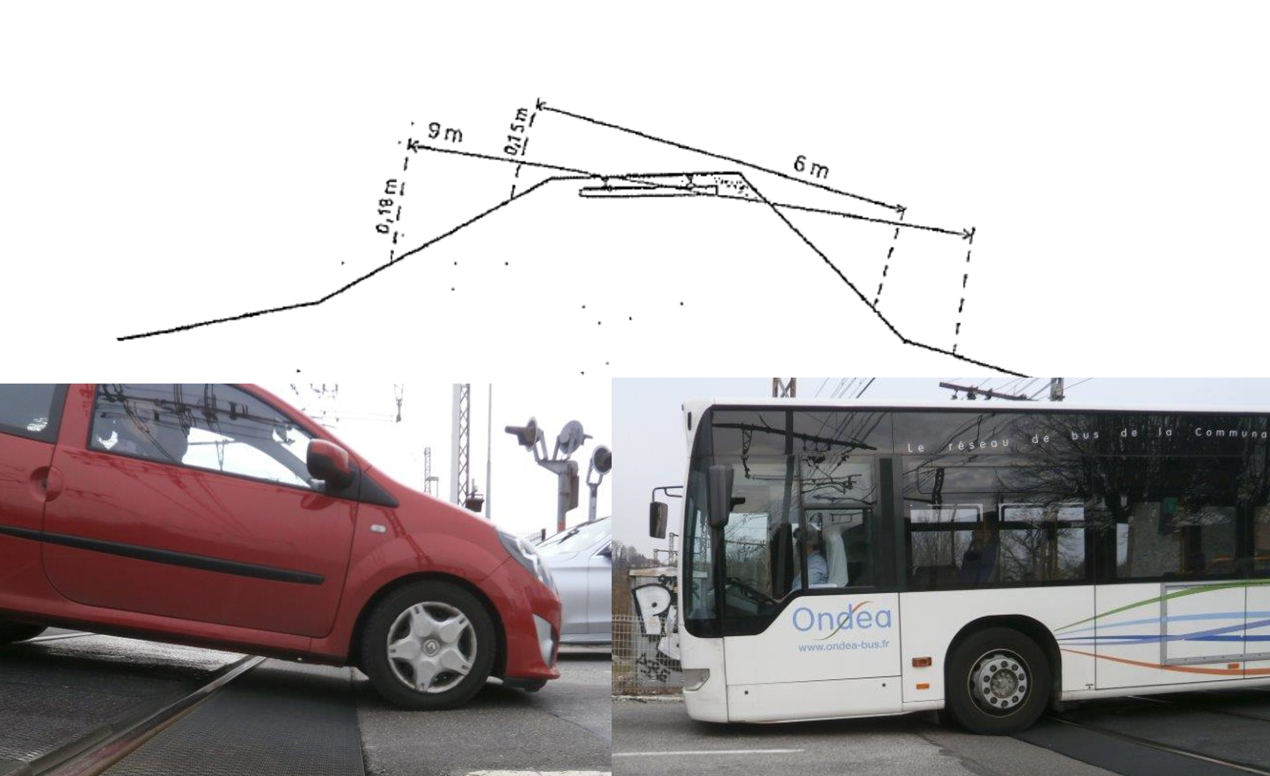
Studying challenging level crossings
Due to the wheelbase and ground clearance, there is a risk of heavy and/or low-clearance vehicles getting caught or stuck.
To assess the danger of level crossings, we offer a service to study difficult-to-cross level crossings in order to:
Would you like to learn more about this service?
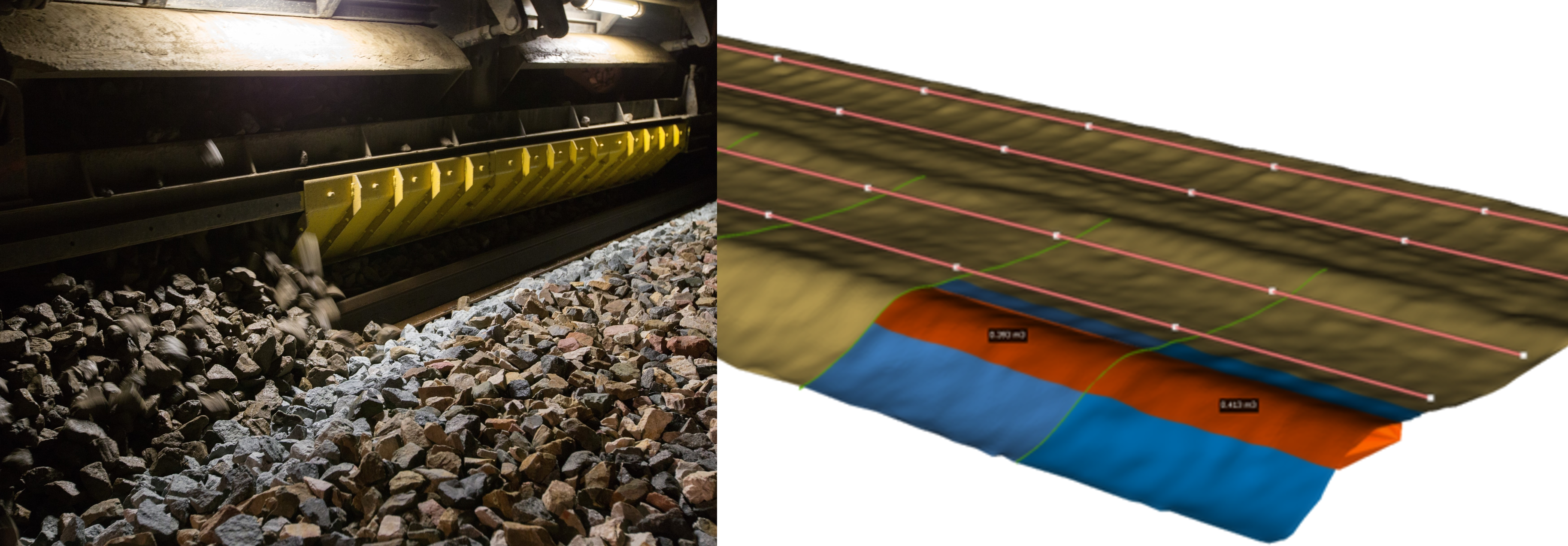
Optimizing expenditures associated with ballast
To provide railway infrastructure managers with the tools to optimize expenses related to ballast, we automate the processing of LiDAR point clouds. We perform various types of processing:
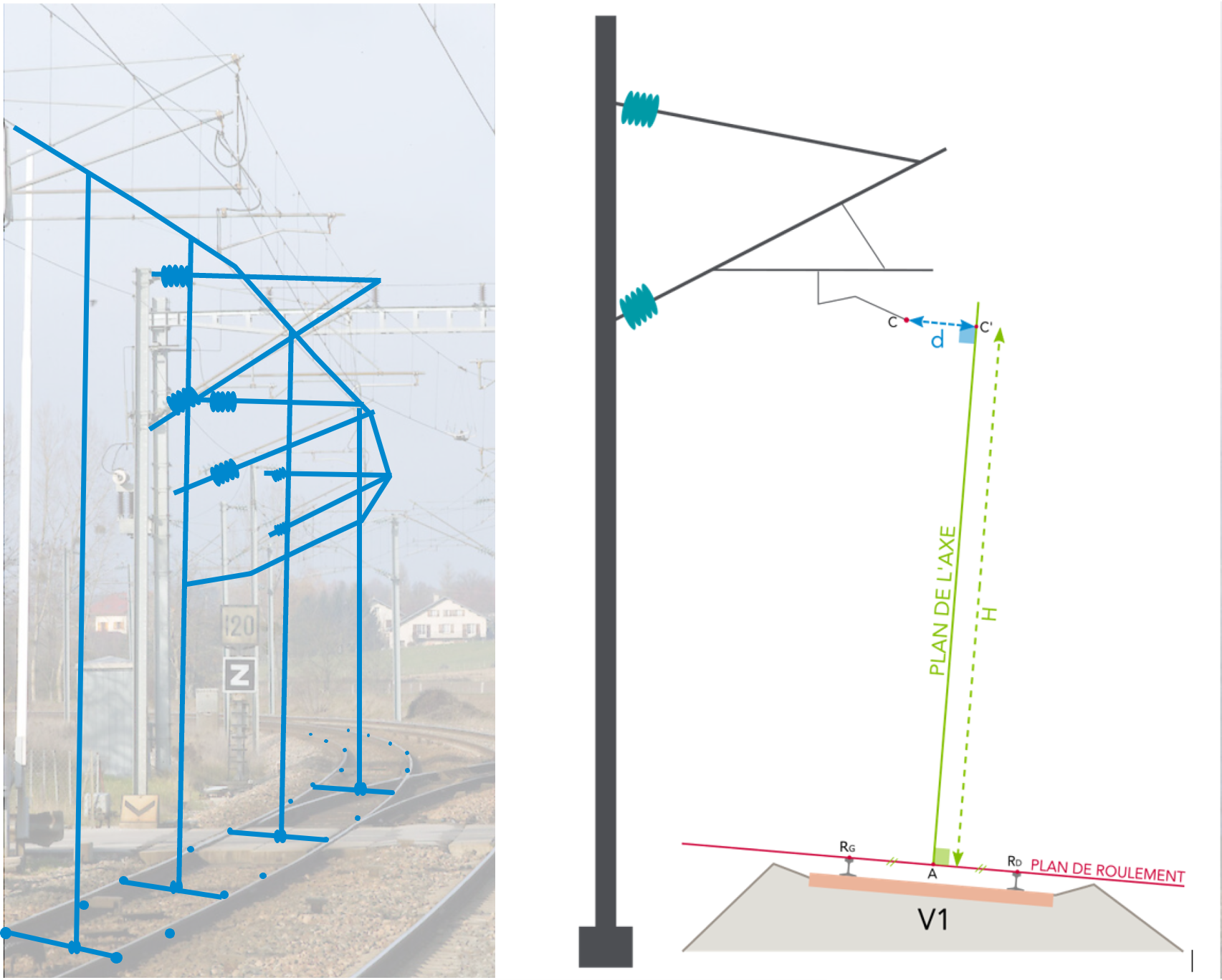
Measuring catenary geometry
Would you like to learn more about this service?
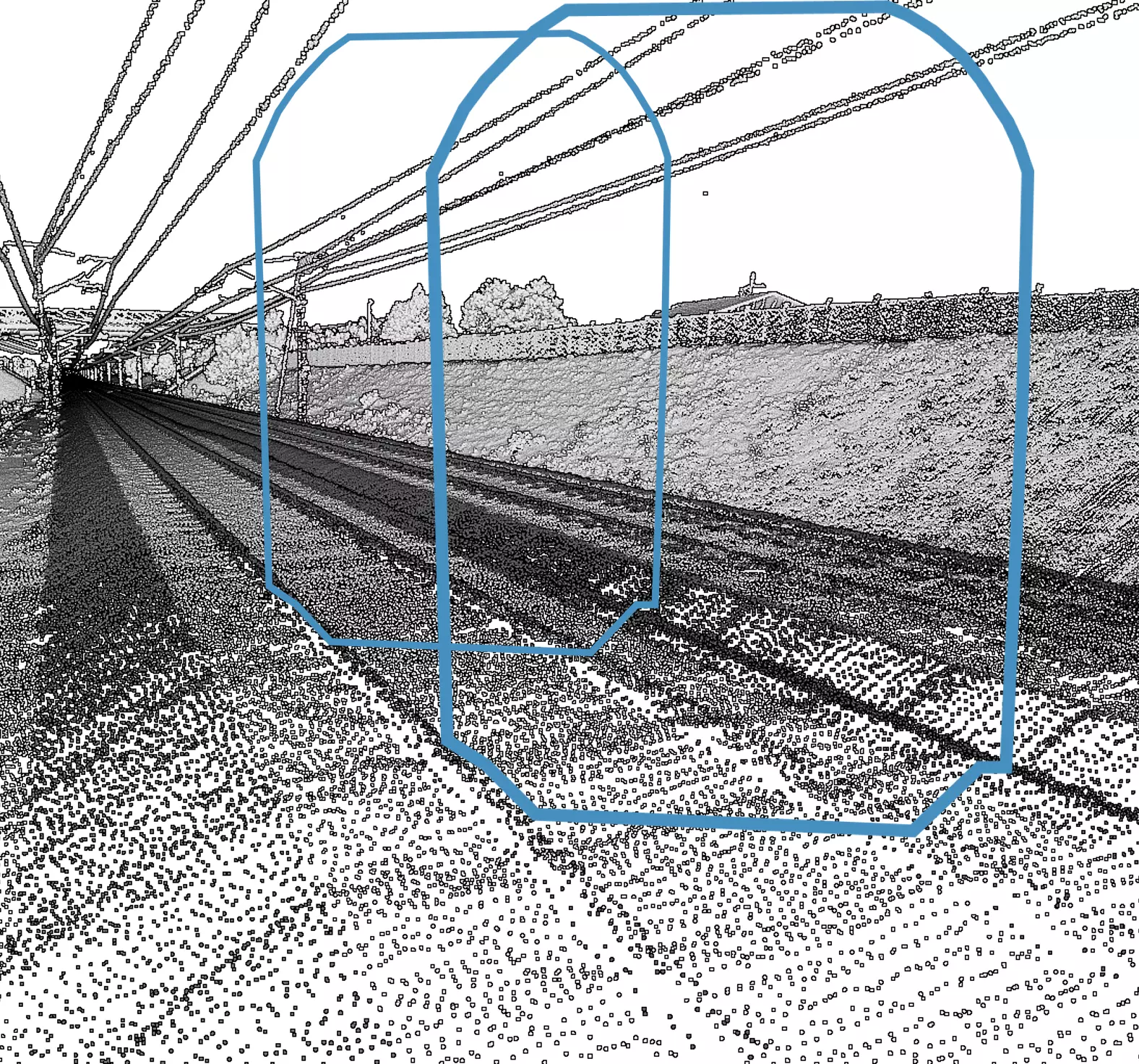
Railway clearance analysis
Dynamically generate the profile of the clearance at any point based on track geometry Detect and assess obstacles infringing on railway clearance Promote network interoperability for all types of railway convoys by studying specific clearances.
Would you like to learn more about this service?


 Contact us!
