
 Contact-us


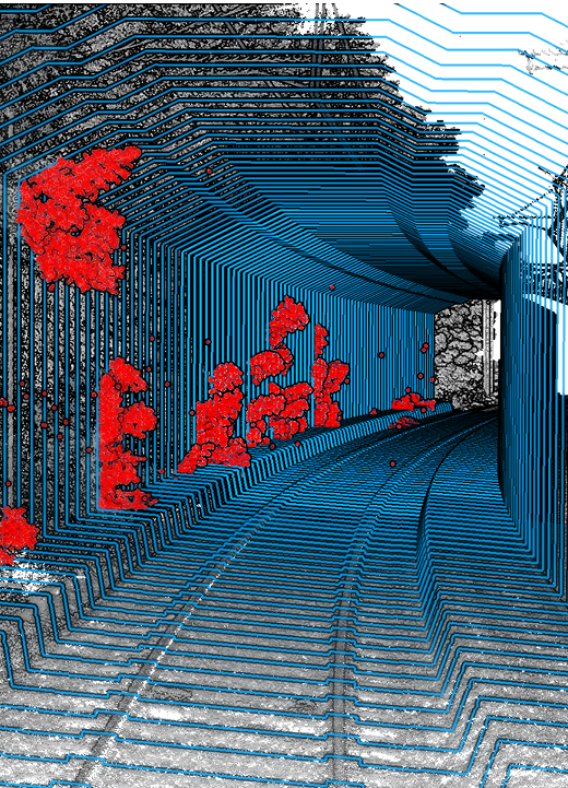
![]() Over the first five months of 2025, thanks to our DataLidar platform, the point‑cloud extractions already completed represent approximately €500,000 in gross savings.
Over the first five months of 2025, thanks to our DataLidar platform, the point‑cloud extractions already completed represent approximately €500,000 in gross savings.![]()

![]() Workspace
Workspace
It’s the application that allows you to create and visualize projects from your data-while also enabling you to leverage them and collaborate seamlessly with your teams and/or your clients.

![]() Factory
Factory
It’s the application dedicated to the production workflow, quality enhancement, and validation of 3D LiDAR data.

![]() Catalog
Catalog
It is the application that streamlines the storage and retrieval of large volumes of geospatial data.

![]() 2D Visualization
2D Visualization
With the 2D geographic data visualization tool, you have access to a wide range of features that allow you to annotate, measure, track historical changes, or compare your data. This enables you to generate an initial level of insight into your infrastructure.
![]() Photogrammetry
Photogrammetry
Orthophotos
Point clouds
![]() Panorama creation
Panorama creation
Altametris Suite includes automatic generation of 360° panoramas. This makes it possible to create virtual tours of your sites and facilities or to monitor the progress of your construction projects.Simply upload your raw data, and Altametris Suite will produce your panoramic views in near real time.
![]() 3D Visualisation
3D Visualisation
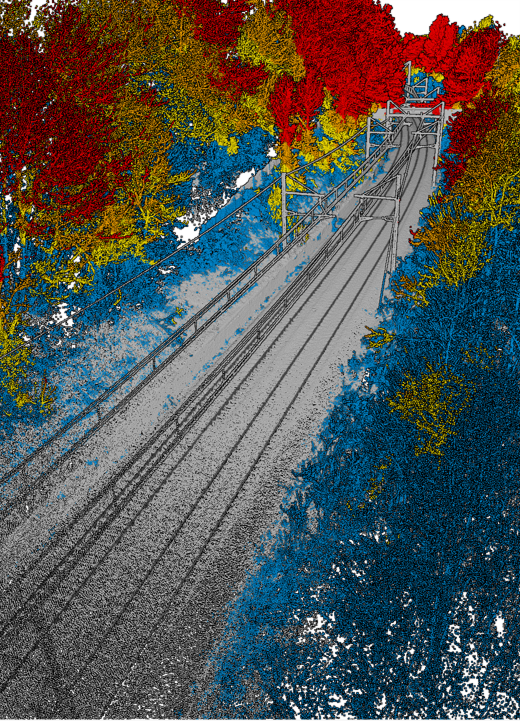
You can directly upload your data to map an infrastructure and/or obtain a full-scale 3D model.
A wide range of features is available, including measurement tools, classification options, cutting tools, and multiple navigation modes within the 3D environment.
![]()
A single tool
that centralizes and visualizes all infrastructures to enable better data correlation.
![]()
A simple and intuitive tool
offering direct web-based access, as well as team and user management.
![]()
Optimized intra-project analysis
enabled by advanced 2D, 3D, and 4D data visualization and comparison features.
![]()
Cutting-edge technologies
integrating the use of AI to automate data processing and generate relevant insights.
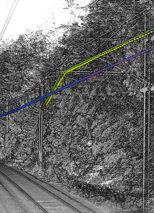
The traction power, supplied by substations distributed along the track, is transmitted through an overhead contact line to the rolling stock, where it is collected by the pantograph’s collector head sliding on the contact wires.
Because continuous contact between the overhead line and the moving train must be ensured at all times, it is essential to precisely determine the geometric position of the contact wires relative to the track, as well as the relative positions of the wires in complex areas.
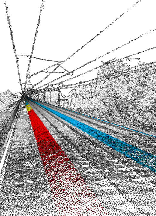
Ballasting and tamping operations, which are essential for track stability and durability, represent a significant expenditure for SNCF Réseau.
For example, in 2019, spending in this area reached 67 million euros, including 61 million in direct costs.
Put our technology to the test: let’s build a new use case together!
Are you an industrial infrastructure manager? Do you have extensive linear assets that need to be analyzed?
Entrust us with your project!
Your data holds tremendous value, and together we can develop new ways to leverage it. Whatever your industry, our technologies adapt to your needs.
![]() Over the first five months of 2025, thanks to our DataLidar platform, the point‑cloud extractions already completed represent approximately €500,000 in gross savings.
Over the first five months of 2025, thanks to our DataLidar platform, the point‑cloud extractions already completed represent approximately €500,000 in gross savings.![]()