 Contact-us


Research & Development at Altametris
As a major player in the digitization of industrial infrastructure data, we have been deploying technology solutions from our R&D for the maintenance of complex industrial infrastructures for over 10 years. Our mission is to initiate, accompany and massify the use of the industrial digital twin at European and global level.
Today, our program covers five key disciplines across two main themes:
data collection (drone, robotics)
data processing (Exploitation of 3D LiDAR data, digital twin, artificial intelligence)
In the future, we intend to continue our R&D efforts and capitalize on the results achieved.
Our internally developed projects
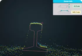
Detection of objects near railway tracks
Find out more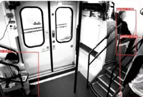
Passenger detection inside train cars
Find out more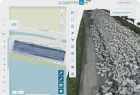
Altametris Suite: industrial digital twin visualization platform
Find out more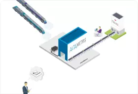
3D Factory: Capitalizing on Data Collected by Track Monitoring Devices
Find out more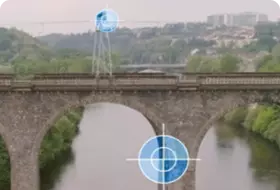
Inspection of civil engineering structures by drone
Find out more
PROJET DINASI
Development of a comprehensive, integrated and functional infrastructure and network monitoring solution based on an autonomous drone system.
PROJET DROSERA
Risk analysis Drones for asset management, design of safe drone systems for inspection and maintenance assistance.
.png?width=348&height=234&name=Group%20288%20(1).png)
IN2SMART
Creation and visualization of digital twins during the design phases of new rail lines or electrification equipment.

DIGITAL TWINS FOR COMPLEX INFRASTRUCTURES & URBAN ECOSYSTEMES PROJECT
Consortium in partnership with the Polytechnic University of Madrid and École des Ponts ParisTech and Industrials for the teaching of a full double master’s degree on digital twins, intended for civil engineers.

SPACE DATA MARKET PLACE
Study of satellite images for the monitoring of the vegetation cover and the approaches to the tracks, to detect changes in land use that may have an impact on the stability of the installations and/or their resistance to climatic hazards. Program supported by the France Relance plan and the CNES.