
Measure the catenary geometry
The traction current, supplied by substations distributed along the track, is carried by an overhead traction line to the locomotive, where it is captured by the pantograph’s collector rubbing against the contact wires.
Since continuous contact between the overhead traction line and the moving train must be maintained, it is crucial to precisely know the geometric position of the contact wires relative to the track, as well as the relative positions of the contact wires in complex areas.
|
Customer needs |
To know at rest the geometric position (the height and offset) of the contact wire(s) forming the catenary in relation to the track, and to be aware of the geometric position at the level of the catenary supports |
|
|
Types of data analyzed |
3D LiDAR point clouds |
|
|
Data acquisition method |
ESV measurement train |
|
|
Method of using the digital twin |
1 |
Identification and sampled extraction of the position of the catenary contact wires along the entire track |
| 2 |
Extraction of attachment points |
|
| 3 |
Measurement of the height and offset of each contact wire |
|
|
|
4 |
Identification of the support numbers to associate each attachment point with the corresponding pole number |
|
Benefits for the client |
|
|
|
What is LiDAR ? |
|
LiDAR, which stands for "Light Detection and Ranging" or "Laser Imaging Detection and Ranging," is a distance measurement technique based on the analysis of the properties of a light beam returned to its emitter. A LiDAR system is an optoelectronic device consisting of a laser emitter, a receiver with a light collector (such as a telescope or other optics), and a photodetector that converts light into an electrical signal. It also includes an electronic signal processing chain that extracts the desired information. LiDAR data collected forms a three-dimensional point cloud with up to 7,000 points per square meter, providing a highly detailed and precise level of information. |
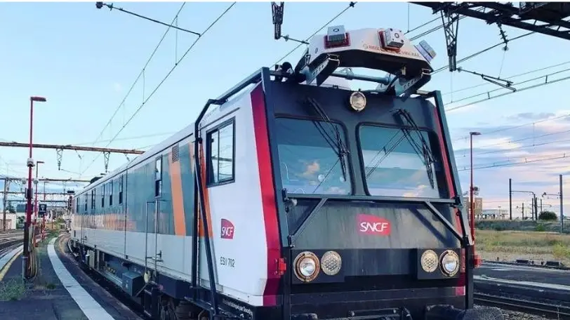
What is a Track Inspection Vehicle (TIV) ?


 Contact us!

.webp?width=51&height=51&name=acquisition%20(1).webp)
