
Detection of telecom faults
Since pedestrian inspections are time-consuming, costly, and disruptive to the operation of the railway network, telecom equipment inspections along the tracks can only be performed once or twice a year to cover the entire 44,000 kilometers. The use of digital twins in this area aims to automate the detection of changes in the condition of installations by leveraging regularly available data.
|
Customer needs |
Detection of missing or damaged slabs, cable ducts, trackside phones, and shelters; open hatches; broken fencing; and landslides near the tracks |
|
|
Types of data analyzed |
3D LiDAR images and point clouds |
|
|
Data acquisition method |
Measurement train |
|
|
Method of using the digital twin |
1 |
Creation and training of 3 algorithmic modules for :
|
| 2 |
Point cloud segmentation for data analysis and detection of three-dimensional objects |
|
| 3 |
Evaluation of the detection model's performance (proportion of target objects correctly detected by the model) |
|
|
Benefits for the client |
|
|
|
What is LiDAR ? |
|
LiDAR, which stands for "Light Detection and Ranging" or "Laser Imaging Detection and Ranging," is a distance measurement technique based on the analysis of the properties of a light beam returned to its emitter. A LiDAR system is an optoelectronic device consisting of a laser emitter, a receiver with a light collector (such as a telescope or other optics), and a photodetector that converts light into an electrical signal. It also includes an electronic signal processing chain that extracts the desired information. LiDAR data collected forms a three-dimensional point cloud with up to 7,000 points per square meter, providing a highly detailed and precise level of information. |
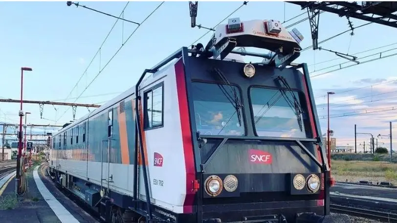
What is a Track Inspection Vehicle (TIV) ?


 Contact us!

.webp?width=51&height=51&name=acquisition%20(1).webp)
