
 Contact-us


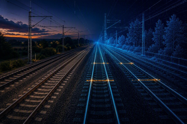
For railway infrastructure managers, knowledge of track center distances is essential. Whether ensuring safe train crossings, preparing a track slewing operation, assessing the introduction of new rolling stock, or validating an infrastructure modernization project, accurate understanding of the spacing between adjacent tracks is a prerequisite for both safety and operational performance.
Yet, despite the strategic importance of this information, track center assessments are still frequently performed through dedicated field surveys. Teams equipped with manually pushed measuring trolleys, topographic instruments, or specialized gauging systems must physically access the infrastructure, operate within constrained possession windows, and collect measurements over often limited sections of track. While effective, these methods are inherently time-consuming, costly, and difficult to scale across large railway networks.
Altametris Suite and its ability to leverage large-scale railway digital twins built from LiDAR data is transforming this approach. Rather than measuring individual locations on demand, infrastructure managers can now access a continuously available and highly accurate three-dimensional representation of their network and perform track center assessments remotely, at any time, and across thousands of kilometers simultaneously.
A Strategic Infrastructure Parameter
Track center distance may appear to be a simple geometric measurement, but its impact extends far beyond surveying activities.
It directly influences the ability of trains to cross safely, especially on curved sections where vehicle overhang increases and clearance margins become more critical. It must also be taken into account whenever infrastructure modifications are planned, including track renewals, alignment corrections, speed upgrades, station remodeling projects, or capacity enhancement programs.
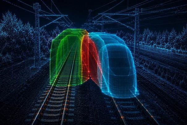
For engineers, obtaining reliable track center information has traditionally meant launching dedicated measurement campaigns. However, these surveys often focus only on the area under study, providing a limited view of the network and sometimes leading to repeated measurements being carried out by different projects over the years.
The result is a fragmented understanding of infrastructure constraints, where significant resources are spent collecting information rather than exploiting it.
The Digital Twin as a Permanent Measurement Environment
The deployment of mobile LiDAR systems is changing this paradigm.
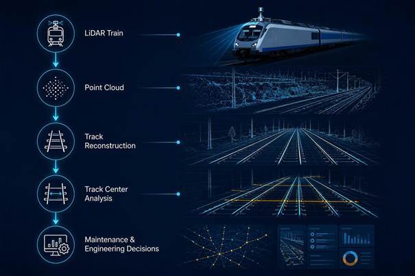
Mounted on inspection trains, diagnostic vehicles, or dedicated survey platforms, modern laser scanning systems can capture millions of measurements every second while travelling at operational speed. Within a single day, hundreds of kilometers of railway corridor can be digitized or updated, generating a dense and precise three-dimensional point cloud representing every visible element of the infrastructure.
Once processed with Altametris’ algorithms in its platform, this data forms a railway digital twin: a virtual replica of the network that can be explored, measured, and analyzed without requiring additional field visits.
With Altametris Suite Factory, track center distance ceases to be a value measured occasionally in the field. Instead, it becomes a continuously available attribute of the network, accessible to engineers whenever needed.
Moving from Measurement to Analytics
The true value of a digital twin lies not only in its ability to represent reality, but also in its capacity to automate analysis.
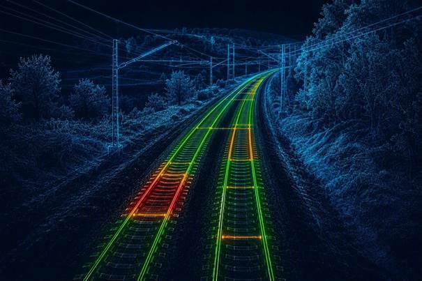
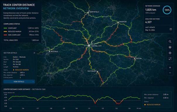
That’s exactly what Altametris Suite offers through advanced algorithms that can automatically reconstruct track geometry from LiDAR data, identify rail positions, calculate track center distances, and account for the actual characteristics of the infrastructure. The analysis provided by Altametris can then be performed continuously along the railway corridor, providing a complete inventory of track spacing conditions.
Rather than receiving isolated measurements at a handful of locations, infrastructure managers gain a comprehensive and homogeneous view of the network. Areas where spacing is reduced, where future works may be constrained, or where additional engineering review is required can be identified immediately.
Usage of Altametris Suite for railway infrastructure manager’s everyday operations transforms a traditionally labor-intensive survey activity into a strategic decision-support process.
De-Risking Track Slewing and Modernization Projects
One of the most compelling applications concerns track slewing operations.
Before shifting a track laterally, engineers must ensure that sufficient spacing remains between adjacent tracks while preserving compatibility with structures, platforms, and operational requirements. Traditionally, this verification would require dedicated topographic surveys and multiple site inspections.
A digital twin dramatically simplifies the process. Engineers can analyze existing conditions remotely, evaluate multiple design scenarios, and quickly identify sections where spacing could become critical. Decisions that previously took days or weeks can now be taken in hours with the support of Altametris solutions.
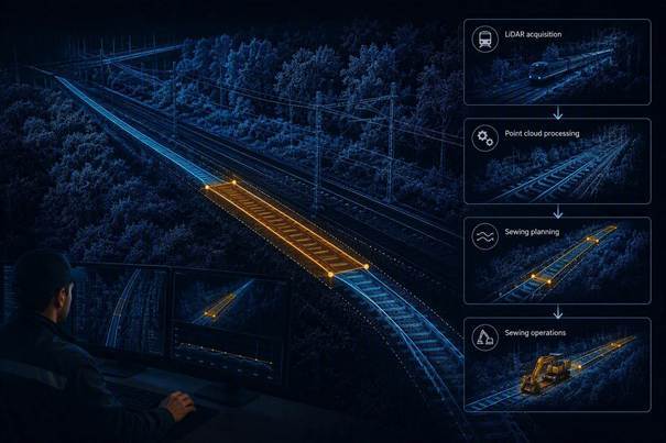
The same benefits apply to renewal projects, electrification schemes, station upgrades, and capacity enhancement programs. Because the underlying data already exists, engineering studies can begin immediately rather than waiting for new surveys to be commissioned.
Improving Safety While Reducing Field Exposure
Beyond productivity gains, use of Altametris Suite and its digital twin approach also offer important safety benefits.
Reducing the need for personnel to access operational railway environments decreases exposure to trackside risks and minimizes the number of interventions required on active infrastructure. At the same time, the ability to analyze the entire network rather than isolated sections makes it easier to identify potential issues before they impact operations.
Infrastructure managers move from a reactive approach, where measurements are made in response to a specific need, to a proactive model based on continuous infrastructure knowledge.
A Foundation for Data-Driven Asset Management
The benefits of Altametris Suite extend well beyond engineering studies.
When integrated into asset management platforms, GIS environments, and maintenance systems, track center analytics become part of a broader digital ecosystem. Detected constraints can be georeferenced, documented, prioritized, and tracked over time. As new LiDAR acquisitions are performed, the digital twin can be refreshed, creating a living inventory of infrastructure conditions across the entire network.
This approach maximizes the value of data acquisition investments. A single LiDAR survey can simultaneously support track center analysis, clearance assessment, vegetation management, ballast evaluation, catenary monitoring, and numerous other use cases which can all be leveraged in the same environment thanks the portfolio of business modules offered by Altametris.
Conclusion
Railway infrastructure management is entering a new era. The industry is progressively moving away from a model where critical engineering decisions depend on repeated site surveys, isolated measurements, and fragmented infrastructure data. Thanks to large-scale LiDAR acquisition and digital twin technologies, the railway network can now be understood, measured, and analyzed continuously at unprecedented scale.
For track center assessment, the benefits are immediate: fewer field campaigns, accelerated engineering studies, safer train crossing operations, more efficient validation of track slewing projects, and enhanced decision-making throughout the asset lifecycle. Engineers are no longer limited to localized measurements. Instead, they gain network-wide visibility and can identify potential constraints long before they become operational or project-related issues.
In this context, manual measurement tools are evolving from primary data collection instruments into targeted validation tools, deployed only where additional verification is required. The true source of insight becomes the digital twin itself, continuously available and ready to support engineering, maintenance, and investment decisions.
Altametris Suite brings this vision to life. By combining high-precision LiDAR data, automated track reconstruction, and advanced track center analytics, the platform enables infrastructure managers to assess compliance, detect spacing constraints, simulate project impacts, and prioritize interventions directly from a comprehensive 3D representation of their network.
Rather than measuring a few meters at a time, railway organizations can now analyze thousands of kilometers in a consistent, repeatable, and industrialized manner.
With Altametris Suite, track center management evolves from a surveying activity into a strategic digital capability, helping infrastructure managers improve safety, reduce costs, accelerate engineering projects, and unlock the full value of their railway digital twin.

You may also like
ARTIFICIAL INTELLIGENCE
Automatic Detection of Objects near and on Railway Tracks
[Page created in 2024 for translation of original content]
In the series of articles labeled "R&D," we invite you to...
Read more

R&D
Capitalizing on Data Collected by Track Surveillance Vehicles (3D Factory Project)
[Page created in 2024 for translation of original content]
In the series of articles labeled 'R&D,' we invite you to...
Read more
SOFTWARE
Complex Infrastructures: Track the evolution of your 3D data
In the world of infrastructure and railway asset management, capturing high-quality data is only half the battle. A 3D...
Read more